

Published on: 10/29/2026
This news was posted by Oregon Today News


Description
Loading...
This winter is expected to be warmer and wetter, as national weather agencies point to a “Super El Niño” altering weather patterns across the globe.
The latest forecast from the National Oceanic and Atmospheric Administration estimates there will be warmer-than-average temperatures across much of the continental U.S., accompanied by above-average precipitation in several regions.
El Niño years are also associated with coastal flooding on the Eastern seaboard and the West Coast.
“It’s a strong, if not historic El Niño going into this winter,” Ken Graham, the director of NOAA’s National Weather Service, said at the same October media briefing that Graham addressed.
Forecasters caution, however, that these predictions are just that, predictions. El Niño can shift the odds toward certain conditions but it does not ensure they will happen.
Still, the latest forecasts can help provide a roadmap for cities to prepare for potential impacts and allocate resources.
“These seasonal predictions are key to helping you prepare and giving you a heads up to assess all the risks and how to mitigate them,” said Graham.
“Earlier and better decisions saves lives,” he said.
It’s not all negative. Forecasters say this year’s El Niño could bring rainfall to areas experiencing drought conditions.
The origins of El Niño
El Niño is a natural climate pattern that starts in the tropical Pacific Ocean. Every few years, a vast area of water in the eastern Pacific warms near the equator. That water releases enormous amounts of heat into the atmosphere, shifting weather patterns around the world. This year, meteorologists say the planet could experience the strongest one on record.
Loading...
This El Niño weather pattern is on top of warming temperatures that result from fossil fuel emissions, which trap more heat in the atmosphere.
Josh Willis, a climate scientist at NASA’s Jet Propulsion Laboratory, uses the term “Godzilla” to describe both the size and the actual impact of El Niño — “like a monster that stretches all the way across the ocean.” (He credits his colleague Bill Patzert with coining the term).
“It rises up out of the ocean like Godzilla, and it breathes fire on Indonesia and Southeast Asia: they’re having severe drought and major wildfires,” Willis says. “Its tail is kicking up hurricanes and storms and high tides on our end of the Pacific.”
During another strong El Niño event in 2015-16, catastrophic flooding hit South Carolina and a blizzard walloped the East Coast.
Here’s how El Niño may affect your region.
West Coast, wet coast
Forecasters expect warmer temperatures in Northern California, and above-average precipitation across the state, particularly in Southern California. There’s also a chance for higher snowfall in parts of Nevada, the southern Rocky Mountains and California’s San Bernardino Mountains.
This year’s El Niño’s effects were first felt on the West Coast with the arrival of a Kelvin wave. In early October, the large band of warm water raised sea levels as it moved north along the coast, bringing with it an elevated risk of floods and warmer ocean temperatures.

By themselves, Kelvin waves don’t cause flooding, said Dillon Amaya, an assistant professor of atmospheric sciences at North Carolina State University. Instead, they load the dice, he says, increasing the likelihood of flooding.
In early October, a Kelvin wave was one of the factors behind the extensive coastal flooding associated with Tropical Storm Rachel, Amaya says
Another Kelvin wave is now raising sea levels along California’s coast. As of late October, the wave was between Los Angeles and San Francisco. Amaya said. Several more waves are expected through the fall and early winter.
The Pacific Northwest will warm but get less rain
Similar to the California coast, researchers expect the Pacific Northwest to experience warmer temperatures. But unlike much of the West Coast, parts of the region are forecasted to receive below-average precipitation. And without colder weather, where the temperatures drop and stay below zero, the result will likely be a smaller snowpack.
(Deep snowpacks can hold more water and slow melting snow feeds streams and rivers and helps sustain reservoirs.)
The region is already experiencing years of drought. And dry forests and parched soils significantly increase the likelihood and severity of wildfires.
Along the Pacific Northwest shorelines, communities are preparing for severe flooding. Many of these low-lying areas are shoring up and getting infrastructure repaired as they face a possible double whammy from El Niño and winter’s high tides.
At the same time, parts of Western Washington and Oregon have experienced successive years of drought. Jon Gottschalck, a meteorologist and branch chief for NOAA, who spoke at the same October media briefing that Graham did, said that he expects dry conditions for western portions of Oregon and Western Washington state to improve and for drought conditions to potentially end.
Heavy rains in the Southwest won’t end water crisis
The Southwest is already experiencing the anticipated wetter-than-average conditions.
Severe flooding in the Four Corners region, where the borders of New Mexico, Colorado, Arizona, and Utah meet, caused water levels to rise, and forced dramatic rooftop rescues and evacuations in late October. The area already had two months of unusually wet weather.

Daniel Swain, a climate scientist with the University of California Agriculture and Natural Resources, a statewide research division, said El Niño is partly to blame for the recent floods. The severe thunderstorms were fueled by large amounts of moisture in the atmosphere.
That moisture, said Swain, comes from the record-warm waters off parts of the West Coast, which are driven by El Niño and a recent marine heat wave. He emphasizes that the heat wave can largely be attributed to human-caused climate change.
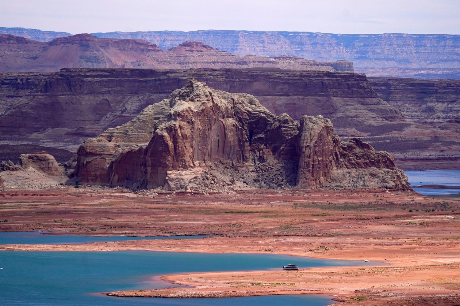
However, Swain cautioned that the wetter-than-average conditions do not mean an end to the ongoing water crisis in the Colorado River basin. Years of drought and growing demand for water have left Lake Powell and Lake Mead— reservoirs that supply water to millions of people in the Southwest—at record low levels.
“What would it take to refill all of the huge reservoirs in the Colorado system and to maintain them at that level for long enough to really change the bigger picture?” Swain asked.
“The amount of water that would be required to do that,” he paused, “it’s difficult to comprehend.”

The East Coast and nor’easters
Similar to the overall U.S. weather trend this winter, forecasts show the Northeast could have both warmer temperatures and above-average precipitation.
Studies also suggest that El Niño can strengthen and accelerate the frequency of nor’easters by pushing warm, moist air to the north. And nor’easters, along with high tides, can lead to coastal erosion up and down the coast.
Forecasters are predicting that the northeast and Mid-Atlantic will experience similar amounts of flooding as happened during a 2023 El Niño event — a record setting year.
They say there could also be more snow. During the strong El Niño of 2016, a brutal northeast blizzard produced over 30 inches of snow and 60 mph wind gusts.
“El Niño can favor a more mild than average winter in the northern United States, but listen, in the winter months it doesn’t mean you won’t have snow,” Graham, NOAA’s director, said. “It doesn’t erase the risk.”
The South has the best chance of above-average precipitation
The greatest chance for above-average precipitation is predicted for areas of the southern U.S. There also may be snow in areas that rarely, if ever, see it. That includes northern Texas, NOAA’s Gottschalck said.
Florida is already bracing for heavy amounts of rain in areas that don’t normally experience huge downpours. The northern part of the state, along with southern parts of Georgia and South Carolina, have the highest chance across the continental U.S. of above-normal precipitation this winter. This follows an unusually quiet Atlantic hurricane season with only one named hurricane, Isaias, roiling the Florida panhandle.
Still, the state’s tornado risk is typically higher during El Niño years. In 1998, during an intense El Niño event, NPR’s member station, WUSF, reported that Central Florida experienced one of the deadliest tornado outbreaks, killing 42 people.
Less snow likely for the Midwest
The Midwest—especially in the Upper Midwest—is expected to have a smaller snowpack than normal because of warmer temperatures.
Michigan, Ohio and Indiana tend to be drier during El Niño winters, while Iowa tends to be wetter, according to the U.S. Geological Survey.
Gottschalck said the drought situations are expected to persist this winter across the Midwest. In fact, there is growing concern the current drought will only get worse.
News Source : https://www.opb.org/article/2026/10/29/here-s-the-el-nino-winter-forecast-for-the-u-s-warmer-and-wetter/
Other Related News

10/29/2026
Republican Alaska Gov Mike Dunleavy has ordered an investigation into the Democratic candi...
10/29/2026
Kristoffer Velde scored a goal in each half and added an assist to lead Portland to a 3-2 ...
10/29/2026
Defenseman Brandon Montour scored with 34 seconds left and the Seattle Kraken beat the Tor...
10/29/2026
Flight cancellations and delays disrupted operations at multiple US airports Thursday

10/29/2026
UTSA mens basketball coach Austin Claunch has been suspended just before the start of the ...

Follow

Download Our App


Copyright 2022 © EPUERTO. All Rights Reserved