Top Weather StoriesPatchy areas of dense fog Friday and Saturday morningLow elevation snow possible 4 PM Saturday - 4 AM SundayHighs in 30s/40s, lows in 20s/30sLook below to read more!1. Patchy areas of dense fog Saturday morningModel consensus is suggesting more areas of patchy dense fog for Saturday morning, specifically for the Kittitas valley. Looks like most of it should lift by 10 AM Saturday. Any fog that develops Saturday morning will be freezing fog, just given the colder overnight lows.
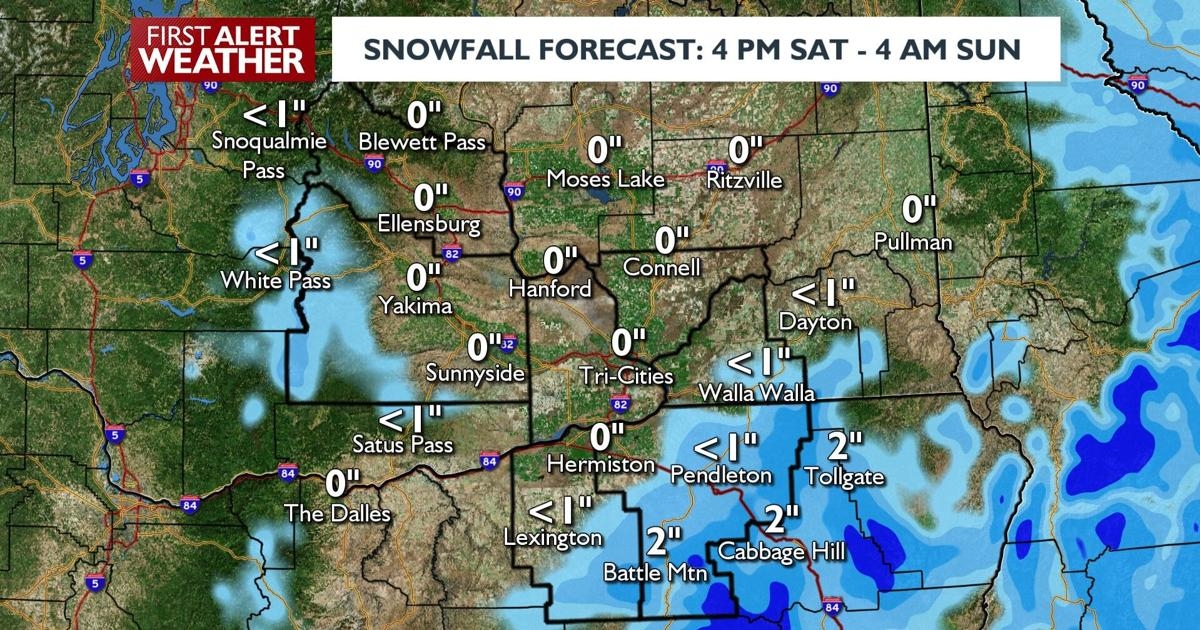
2. Low elevation snow possible 4 PM Saturday - 4 AM SundayA quick hitting storm system will bring low-end precip chances to our region Saturday night into Sunday morning. Snow levels will be low enough to where lower elevations could see some flurries flying. Overall, accumulations will be light, but models have turned a bit more aggressive with snowfall totals in the Blue Foothills and Blue Mountains.
3. Highs in 30s/40s, lows in 20s/30sWe’ll turn a bit colder starting Friday night into Saturday morning. Overall, though, our airmass will stay typical for late November and early December.
Extended Forecasts
COPYRIGHT 2025 BY APPLE VALLEY NEWS NOW. ALL RIGHTS RESERVED. THIS MATERIAL MAY NOT BE PUBLISHED, BROADCAST, REWRITTEN OR REDISTRIBUTED.
